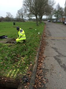
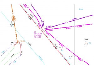
RGL Surveys Subsurface Utility Tracing and Mapping department was established in January 2020, we offer a variety of services aimed at the detection, verification and location of underground services, using industry leading, state of the art equipment to produce plans to the highest quality.


We use two geophysical location techniques to detect utilities, which are Electromagnetic Location (EML) and Ground Penetrating Radar (GPR).
EML – This method utilises four modes of operation; Direct Connection, Clamp Connection, Induction and Passive Sweep. These methods have been specifically developed for the identification and location of known and unknown utility services on a variety of surfaces, it can also detect smaller diameter cables and metallic services which have had a signal induced onto them.
GPR – This method works by sending a radio signal into the ground through various surfaces to provide information and characteristics upon the return of the signal, this can then be used to determine any services that may be under the surface. It also provides its own transmitter and can detect underground features without a power source, its also able to detect most types of utilities including plastic and other non-metallic services as well as metal.
The main advantage of these location techniques is that they are NDT methods meaning they’re neither invasive nor destructive to the terrain allowing us to accurately locate any services that may be below the surface without causing any damage.
